NEW WARM UP UNDERWAY
Late season cold has begun to ease with the return of southerly winds. Afternoon temperatures jumped 23 degrees from early morning lows in the middle 20s and rose 12 degrees from the cold Tuesday afternoon. High clouds and warmer breezes overnight will provide us with less of a chill. Early morning Thursday temperatures are expected to the middle to upper 30s.
APRIL SNOWFALL
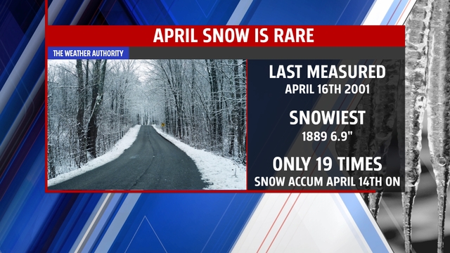
The rare April snowfall of Monday and Tuesday will go into the record books. It has been 13 years since snow accumulated in the month of April – and even more stunning – only the 18 the and 19th time it has ever happened in 143 years of weather records only 13% of the years. Snow this late in the season. The recent chill has produced late season snow cover of 19.4% across the nation.
3 MONTHS IN 3 DAYS
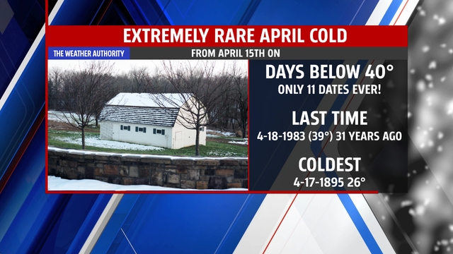
April 15th 2014 was the coldest “tax day” ever on record – breaking a 86-year-old record for coolest/maximum temperature. The high of 38° Monday was more typical for a January afternoon. The high temperature reached 50° Wednesday – still 14 degrees below normal and more typical for early March. Thursday, temperatures surge back above 60° and feeling more like April!
MILDER PATTERN – SOME RAIN CHANCES
A weak front will approach the state Thursday afternoon increasing clouds and possibly bringing some light rain through Friday. Temperatures will run near to just slightly below normal to end the works week and into the weekend. 7 Day rainfall estimated off 2 long-range computers averages only .48”. Showers are possible late Thursday, Friday then late Sunday, Monday and early Tuesday
CHECKING IN ON SPRING 2014
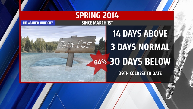
Mid-way through April – the halfway point of meteorological spring and you guessed it – it’s been a cold one. Since March 1st (we use the months of March/April and May as the “spring” months) 64% of the days have been below normal with an average temperature of 40.7° to date it is the 29th coldest on record. This is the coldest spring to date in 18 years.
Precipitation is running near normal after an extremely wet start to the month of April at 6.47” – just .95” above normal and wettest to date since 2008.
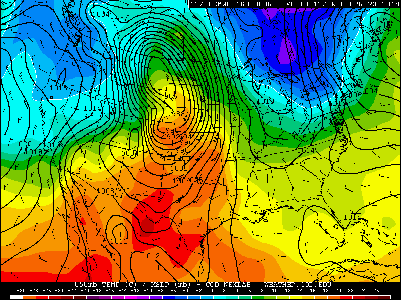
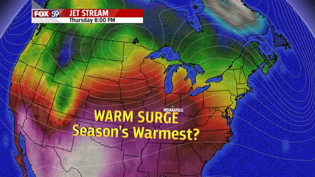
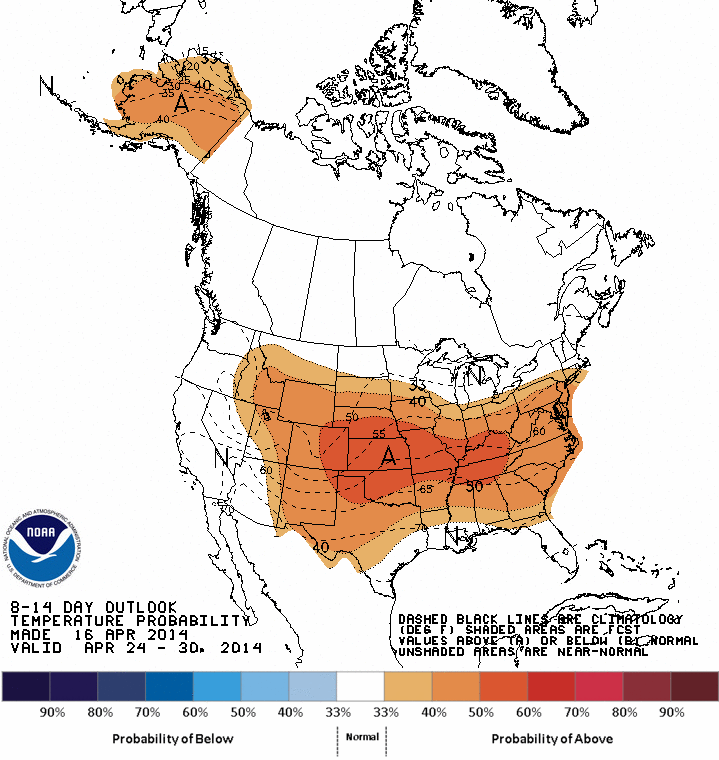
BIG – BRIEF WARM UP NEXT Week – 1ST 80° DAY?
193 days and counting since the last official 80° day here. We are fast approaching the average date of our first 80° day (April 21st) and there are hints that a strong spring storm later net week could send temperatures here surging to the 80° mark. Stay tuned! The US GFS model hints at above normal temperatures for much of the US for the final week of April. Final image below the latest 8-14 day outlook from the National Weather Service Climate Prediction Center 8 to 14 day outlook temperatures