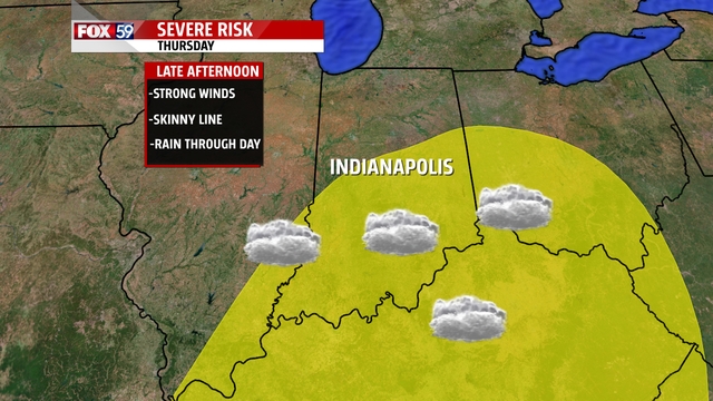
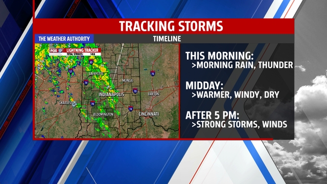
Severe weather is expected today as we will see a cluster of storms moving through from 6 p.m. to 10 p.m. Strong winds are the main threat today followed by heavy rain causing some river flooding. Finally, we cannot completely rule out a tornado although factors are marginal for that.
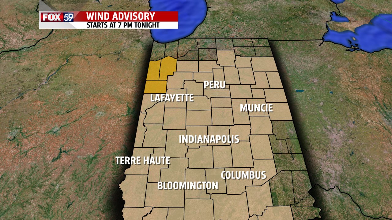
Before the storms arrive we will see morning storms and then isolated storms and showers throughout the rest of the day. Temperatures will be warmer than the 43 we hit yesterday on the backs of strong winds from the south. Those strong winds may top 45 mph and due to that the NWS Indianapolis has issued a wind advisory from 7 p.m. today through 7 p.m. Friday.
The driest part of the day will be in the early afternoon and temperatures may hit 60 in a number of communities including here in Indianapolis. We don’t expect to see much sun today and any additional heating ahead of the frontal passage will increase the potential energy that storms may be able to tap into. In fact just looking at the atmosphere it appears that temperatures really need to hit the 60s in order for us to see severe weather today. Anything below that will have a tough go of developing. Enjoy your day and stay safe!
