STEAMY THURSDAY AFTERNOON
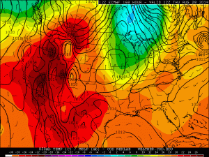
Heating up for some on this Thursday afternoon. Atmosphere is in the recovery room so to speak after early morning storms. Big rains fell over Delaware, Grant and Madison County’s keeping temperatures cooler and this spread in temperatures could be the breeding ground of early evening storms northeast.
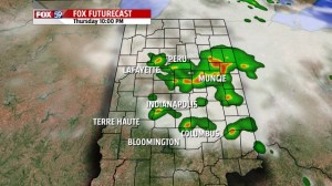
New rounds of heavier storms are possible later tonight perhaps before midnight. Locally heavy rainfall, gusty winds are possible along with vivid lightning. We will be tracking the timing on these storms so be sure to tune in.

RISING TEMPERATURES
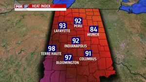
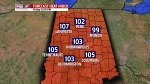
The heat is surging and heat index in the city hit 92° at 5 PM. A warm front is inching north and will stall through Saturday keeping storm chances around. The forecast heat index for Friday soars reaching 100° in many spots.
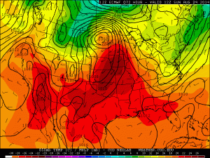
Real heat is coming – and really takes hold Sunday – storm chances Friday and Saturday will make the elusive 90° mark a tougher proposition. There will be dry time both days so we feel we will get the first 90 of the season and there is no doubt Sunday through Tuesday it will be 90+ with heat index well over 100°.
Thursday marks the 344th day since the last 90° officially in the city, ties 1990 for 6th longest stretch all-time.
RELIEF LATE WEEK
Cold front breaks the back of the heat Wednesday with a refreshing change to milder air again Thursday.